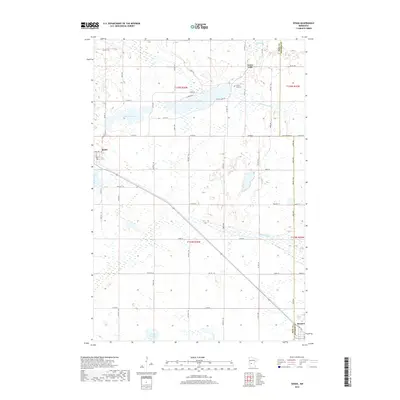
2019 Map of Sedan
USGS Topo · Published 2019About this map
Sedan and the western edge of Brooten anchor this landscape along the border of Pope and Stearns Counties. The terrain is defined by a dense network of glacial wetlands and water bodies, including McCloud Lake and Tracey Slough, which feed into the N Fork Crow River and Sedan Brook. This map documents a traditional rural Minnesota layout, where small clusters of settlement like Grove Lake persist near established landmarks such as the Grove Lake Cem.
Find a feature on this map
58 named features on this map. Tap any name to fly to it.
Don’t see what you’re looking for? This feature index may not catch every label — zoom into the map to look around manually.
Map Details
Editions of this 2019 Sedan Map
This is the sole edition of this map. No revisions or reprints were ever made.
Other maps of this area

1953 · Saint Cloud
USGS Topo · 1:250,000

1957 · Saint Cloud
USGS Topo · 1:250,000

1958 · Saint Cloud
USGS Topo · 1:250,000

1965 · Westport
USGS Topo · 1:24,000

1965 · Padua
USGS Topo · 1:24,000

1965 · Sedan
USGS Topo · 1:24,000

1965 · Raymond Lake
USGS Topo · 1:24,000

1967 · Belgrade
USGS Topo · 1:24,000

1967 · Lake Johanna
USGS Topo · 1:24,000

1968 · Terrace
USGS Topo · 1:24,000