
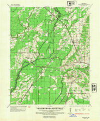
1935 Map of Sedgwick
USGS Topo · Published 1936About this map
The Cache River and its complex network of drainage ditches dominate this Northeast Arkansas landscape, reflecting a massive mid-century effort to reclaim the lowlands for agriculture. East of the river, the rising elevation of Crowley Ridge provides a distinct geographic contrast, hosting settlements like Bono and Sedgwick. The area is characterized by small, rural communities and a high density of country schools and churches that served as the social backbone for farming families.
Find a feature on this map
77 named features on this map. Tap any name to fly to it.
Don’t see what you’re looking for? This feature index may not catch every label — zoom into the map to look around manually.
Map Details
Editions of this 1935 Sedgwick Map
2 editions found
Other maps of this area

1932 · Walnut Ridge
USGS Topo · 1:62,500

1934 · Powhatan
USGS Topo · 1:62,500

1935 · Powhatan
USGS Topo · 1:62,500

1935 · Alicia
USGS Topo · 1:62,500

1935 · Tuckerman
USGS Topo · 1:62,500

1935 · Walnut Ridge
USGS Topo · 1:62,500

1939 · Weiner
USGS Topo · 1:62,500

1939 · Jonesboro
USGS Topo · 1:62,500

1940 · Dee
USGS Topo · 1:62,500

1940 · Gainesville
USGS Topo · 1:62,500