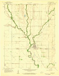
1959 Map of Sedgwick
USGS Topo · Published 1960About this map
The Little Arkansas River meanders through the central Kansas plains, serving as the geographic anchor for the town of Sedgwick. This late 1950s landscape is defined by its agricultural and transit networks, where the Atchison Topeka and Santa Fe railroad corridor runs parallel to the river, connecting smaller stations like Putnam and Van Arsdale. The map captures a detailed view of rural life along the boundary of Harvey and Sedgwick counties, highlighting local landmarks such as Hillside Cemetery and Pleasant Valley Church.
Find a feature on this map
24 named features on this map. Tap any name to fly to it.
Don’t see what you’re looking for? This feature index may not catch every label — zoom into the map to look around manually.
Map Details
Editions of this 1959 Sedgwick Map
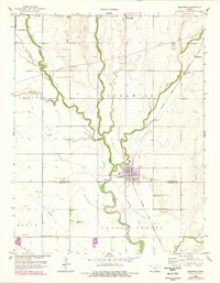
2 editions found
Other maps of this area

1889 · Newton
USGS Topo · 1:125,000

1889 · Cheney
USGS Topo · 1:125,000

1889 · Wichita
USGS Topo · 1:125,000

1891 · Hutchinson
USGS Topo · 1:125,000

1891 · Cheney
USGS Topo · 1:125,000

1893 · Hutchinson
USGS Topo · 1:125,000

1894 · Wichita
USGS Topo · 1:125,000

1894 · Newton
USGS Topo · 1:125,000

1901 · Cheney
USGS Topo · 1:125,000

1941 · Maize
USGS Topo · 1:31,680