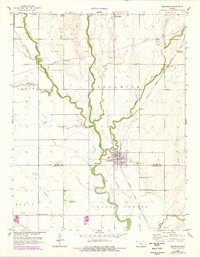
1959 Map of Sedgwick
USGS Topo · Published 1978About this map
The Little Arkansas River dominates this landscape, meandering southward through a prairie region defined by its productive agricultural townships. Sedgwick stands as the primary hub at the confluence of several waterways, its grid of streets and buildings clustered near the Atchison Topeka and Santa Fe railroad line. The map captures a moment of transition where traditional agrarian infrastructure, such as the Pleasant Valley Ch and Hillside Cem, exists alongside modern additions like the network of pipelines and local pits that suggest early industrial resource extraction. The boundary line between Harvey Co Sedgwick Co cuts through the southern portion of the map, illustrating how local governance and property lines were surveyed across the natural drainage basins of Emma Creek and Sand Creek.
Find a feature on this map
23 named features on this map. Tap any name to fly to it.
Don’t see what you’re looking for? This feature index may not catch every label — zoom into the map to look around manually.
Map Details
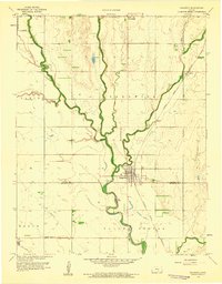
Editions of this 1959 Sedgwick Map
2 editions found
Other maps of this area

1889 · Newton
USGS Topo · 1:125,000

1889 · Cheney
USGS Topo · 1:125,000

1889 · Wichita
USGS Topo · 1:125,000

1891 · Hutchinson
USGS Topo · 1:125,000

1891 · Cheney
USGS Topo · 1:125,000

1893 · Hutchinson
USGS Topo · 1:125,000

1894 · Wichita
USGS Topo · 1:125,000

1894 · Newton
USGS Topo · 1:125,000

1901 · Cheney
USGS Topo · 1:125,000

1941 · Maize
USGS Topo · 1:31,680