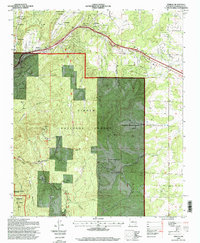
1995 Map of Sedillo
USGS Topo · Published 1998About this map
Sedillo and the high-elevation settlements of the Manzanita Mountains define this landscape east of Albuquerque in the mid-1990s. The map captures a transition from the rugged canyons of the Cibola National Forest to the growing communities along the Tijeras Canyon corridor, where the historic path of Route 66 runs parallel to Interstate 40. Notable for its combination of public lands and scattered mountain enclaves, the area includes the Kirkland Air Force Base and a Department of Energy Withdrawal at its western edge.
Find a feature on this map
47 named features on this map. Tap any name to fly to it.
Don’t see what you’re looking for? This feature index may not catch every label — zoom into the map to look around manually.
Map Details
Editions of this 1995 Sedillo Map
This is the sole edition of this map. No revisions or reprints were ever made.
Other maps of this area

1892 · San Pedro
USGS Topo · 1:125,000

1917 · Estancia
USGS Topo · 1:125,000

1954 · Sandia Crest
USGS Topo · 1:24,000

1954 · Chilili
USGS Topo · 1:24,000

1954 · Sandia Park
USGS Topo · 1:24,000

1954 · San Pedro
USGS Topo · 1:24,000

1954 · Mount Washington
USGS Topo · 1:24,000
1954 · Tijeras
USGS Topo · 1:24,000

1954 · Sedillo
USGS Topo · 1:24,000

1954 · Escabosa
USGS Topo · 1:24,000