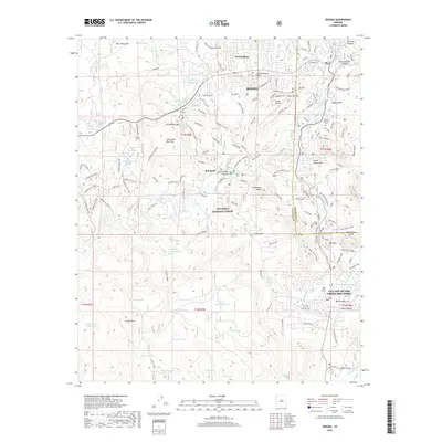
2018 Map of Sedona
USGS Topo · Published 2018About this map
Sedona and its surrounding canyons are documented in this late-2010s survey, revealing a landscape defined by dramatic red rock formations and the sprawling Coconino National Forest. The map captures the suburban expansion of West Sedona and the distinct community of the Village of Oak Creek (Big Park) to the south. Central to the geography are famous landmarks like Cathedral Rock, Bell Rock, and Courthouse Butte, which tower over the desert floor. The intricate trail network, including Made in the Shade and the Courthouse Loop, illustrates the modern transition of the area into a premier destination for hikers and outdoor enthusiasts. Further west, House Mountain stands as a significant geological feature, while numerous water tanks such as Greasy Spoon Tank and John Lee Tank mark the arid back-country terrain.
Find a feature on this map
68 named features on this map. Tap any name to fly to it.
Don’t see what you’re looking for? This feature index may not catch every label — zoom into the map to look around manually.
Map Details
Editions of this 2018 Sedona Map
This is the sole edition of this map. No revisions or reprints were ever made.
Other maps of this area

1887 · Verde
USGS Topo · 1:250,000

1892 · Verde
USGS Topo · 1:250,000

1923 · Camp Verde
USGS Topo · 1:125,000

1932 · Camp Verde
USGS Topo · 1:125,000

1936 · Camp Verde
USGS Topo · 1:125,000

1954 · Holbrook
USGS Topo · 1:250,000

1957 · Holbrook
USGS Topo · 1:250,000

1958 · Holbrook
USGS Topo · 1:250,000

1960 · Holbrook
USGS Topo · 1:250,000
1965 · Munds Mountain
USGS Topo · 1:24,000