2021 Map of Sedona
USGS Topo · Published 2021About this map
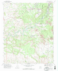
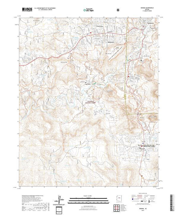
Coconino National Forest encompasses the high desert terrain of this area, where the distinct red sandstone formations of Cathedral Rock and Bell Rock define the southern horizon. The map illustrates the contemporary expansion of Sedona and West Sedona as they spread across Grasshopper Flat, contrasted with the managed preservation of the surrounding public lands. A dense network of modern recreational paths, such as the Templeton Trl and Baldwin Trl, follows the winding course of Oak Creek, which provides a vital riparian corridor through the arid landscape.
Find a feature on this map
87 named features on this map. Tap any name to fly to it.
Don’t see what you’re looking for? This feature index may not catch every label — zoom into the map to look around manually.
Map Details
Editions of this 2021 Sedona Map
This is the sole edition of this map. No revisions or reprints were ever made.
Historical Maps of Sedona Through Time
6 maps found