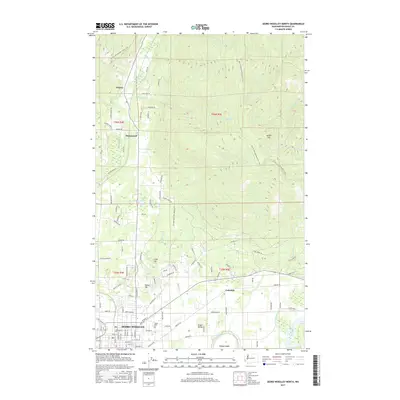
2017 Map of Sedro-Woolley North
USGS Topo · Published 2017About this map
Sedro-Woolley anchors the southwestern corner of this survey, where the valley floor meets the rising slopes of the North Cascades foothills. The map documents the intricate drainage patterns of the region, featuring Hansen Creek and Brickyard Creek flowing toward the Skagit River. Historical land use is visible in the placement of the Old Northern State Hospital Road and the small settlement of Cokedale, reflecting the area's development beyond its timber roots. To the north and east, the elevation climbs significantly toward Lyman Hill, where the Pacific NW National Scenic Trail winds through the high ground.
Find a feature on this map
107 named features on this map. Tap any name to fly to it.
Don’t see what you’re looking for? This feature index may not catch every label — zoom into the map to look around manually.
Map Details
Editions of this 2017 Sedro-Woolley North Map
This is the sole edition of this map. No revisions or reprints were ever made.
Other maps of this area

1911 · Mount Vernon
USGS Topo · 1:125,000

1918 · Samish Lake
USGS Topo · 1:62,500

1921 · Wickersham
USGS Topo · 1:62,500

1940 · Mt Vernon
USGS Topo · 1:62,500

1943 · Mt Vernon
USGS Topo · 1:62,500

1944 · Clear Lake
USGS Topo · 1:62,500

1951 · Wickersham
USGS Topo · 1:62,500

1952 · Lake Whatcom
USGS Topo · 1:24,000

1952 · Alger
USGS Topo · 1:24,000

1954 · Samish Lake
USGS Topo · 1:62,500