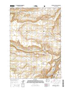
2014 Map of Seekseequa Junction
USGS Topo · Published 2014About this map
Seekseequa Junction anchors this central Oregon landscape, where the plateau terrain is defined by distinct geologic formations and tribal land management. The area is characterized by elevated flats such as Tenino Bench and Metolius Bench, punctuated by volcanic features like Coyote Butte, Luna Butte, and Jackson Buttes. These landforms rise above drainage systems including Tenino Cr and Seekseequa Cr, the latter of which flows toward the southeastern corner near the Seekseequa Cem.
Find a feature on this map
38 named features on this map. Tap any name to fly to it.
Don’t see what you’re looking for? This feature index may not catch every label — zoom into the map to look around manually.
Map Details
Editions of this 2014 Seekseequa Junction Map
This is the sole edition of this map. No revisions or reprints were ever made.
Other maps of this area

1928 · Madras
USGS Topo · 1:125,000

1931 · Madras
USGS Topo · 1:125,000

1955 · Bend
USGS Topo · 1:250,000

1957 · Bend
USGS Topo · 1:250,000

1958 · Bend
USGS Topo · 1:250,000

1962 · Metolius Bench
USGS Topo · 1:24,000

1962 · Fly Creek
USGS Topo · 1:24,000

1962 · Eagle Butte
USGS Topo · 1:24,000
1962 · Seekseequa Junction
USGS Topo · 1:24,000
1962 · Round Butte Dam
USGS Topo · 1:24,000