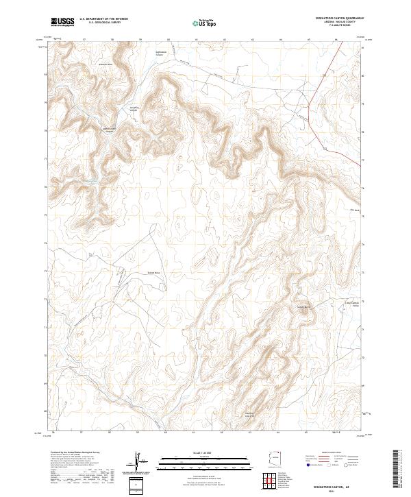
2021 Map of Segihatsosi Canyon
USGS Topo · Published 2021About this map
Segihatsosi Canyon and the high plateaus of the Navajo Nation define this landscape in northeastern Arizona. The map documents a complex system of vertical relief, where flat-topped features like Azansosi Mesa and Tyende Mesa rise abruptly from the surrounding drainage basins. This 2021 survey reveals a remote network of unpaved routes, including Nav Rte 6450 and the Perrish Creek Bus Rte, which trace the accessible floor of the Little Capitan Valley and the surrounding high desert.
Find a feature on this map
18 named features on this map. Tap any name to fly to it.
Don’t see what you’re looking for? This feature index may not catch every label — zoom into the map to look around manually.
Map Details
Editions of this 2021 Segihatsosi Canyon Map
This is the sole edition of this map. No revisions or reprints were ever made.
Other maps of this area

1883 · Marsh Pass
USGS Topo · 1:250,000

1892 · Marsh Pass
USGS Topo · 1:250,000

1952 · Agathla Peak 1 NW
USGS Topo · 1:24,000

1952 · Agathla Peak 2 SW
USGS Topo · 1:24,000

1952 · Agathla Peak 2 NW
USGS Topo · 1:24,000

1952 · Boot Mesa
USGS Topo · 1:62,500

1952 · Agathla Peak 2 SE
USGS Topo · 1:24,000

1952 · Agathla Peak 2 NE
USGS Topo · 1:24,000

1952 · Agathla Peak
USGS Topo · 1:62,500

1952 · Agathla Peak 1 SW
USGS Topo · 1:24,000