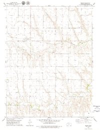
1979 Map of Seguin
USGS Topo · Published 1979About this map
The small settlement of Seguin serves as a focal point in this northwestern Kansas landscape, situated along the Union Pacific railroad corridor. The area's social and community history is anchored by St Martins Cem, located just east of the village. The terrain is defined by the gradual descent toward the South Fork Solomon River and Spring Brook in the southern portion of the map, while Sand Creek cuts across the central plains. Industrial activity is evident through a designated Oil Field and multiple Oil Wells scattered across the township, alongside several Sandpits. The agricultural character of Sheridan County is highlighted by a large Feedlot and numerous water wells, reflecting the intensive land use typical of the High Plains during the late 1970s.
Find a feature on this map
13 named features on this map. Tap any name to fly to it.
Don’t see what you’re looking for? This feature index may not catch every label — zoom into the map to look around manually.
Map Details
Editions of this 1979 Seguin Map
This is the sole edition of this map. No revisions or reprints were ever made.
Other maps of this area

1954 · Goodland
USGS Topo · 1:250,000

1956 · Goodland
USGS Topo · 1:250,000

1957 · Goodland
USGS Topo · 1:250,000

1979 · Menlo
USGS Topo · 1:24,000

1979 · Midway Draw West
USGS Topo · 1:24,000

1979 · Rexford
USGS Topo · 1:24,000

1979 · Hoxie
USGS Topo · 1:24,000
1979 · Rexford NE
USGS Topo · 1:24,000

1979 · Grinnell NE
USGS Topo · 1:24,000
1979 · Grinnell North
USGS Topo · 1:24,000