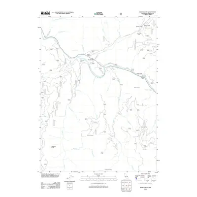
2012 Map of Seiad Valley
USGS Topo · Published 2012About this map
Klamath River flows through the heart of this Siskiyou County landscape, where the small community of Seiad Valley serves as a central hub for the surrounding mountainous terrain. The map documents a network of forest roads and trails, such as Old Seiad Creek Rd and Ladd Rd, which provide access to more isolated locales like Grider Creek Ranch and Hoags Camp. The topography is defined by significant elevations and drainage systems, including Blue Mountain, Slinkard Peak, and the Limestone Bluffs overlooking Grider Creek. Local geography is further detailed through numerous named gulches and springs, such as Lightning Gulch and Maple Spring, alongside established recreational sites like Rocky Bar Campground and Maple Spring Camp. The layout of these features reflects the area's long-standing character as a crossroads for river-based activity and mountain transit in Northern California.
Find a feature on this map
73 named features on this map. Tap any name to fly to it.
Don’t see what you’re looking for? This feature index may not catch every label — zoom into the map to look around manually.
Map Details
Editions of this 2012 Seiad Valley Map
This is the sole edition of this map. No revisions or reprints were ever made.
Other maps of this area

1914 · Seiad
USGS Topo · 1:125,000

1922 · Seiad
USGS Topo · 1:125,000

1948 · Weed
USGS Topo · 1:250,000

1950 · Weed
USGS Topo · 1:250,000

1955 · Seiad Valley
USGS Topo · 1:62,500

1955 · Ukonom Lake
USGS Topo · 1:62,500

1955 · Scott Bar
USGS Topo · 1:62,500

1956 · Happy Camp
USGS Topo · 1:62,500

1958 · Weed
USGS Topo · 1:250,000

1963 · Weed
USGS Topo · 1:250,000