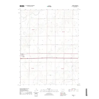
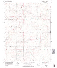
2019 Map of Seibert
USGS Topo · Published 2019About this map
Seibert anchors this landscape of the High Plains, situated at the intersection of a vital transit corridor and the agricultural sections of Kit Carson County. The town layout is defined by its residential grid, featuring named thoroughfares like Colorado Ave and Ohio Ave that run north of the regional highway. Just outside the main settlement, the Seibert Cem provides a local genealogical landmark for the community. The terrain is shaped by the drainage patterns of the South Fork Republican River, which flows across the northern reaches of the quadrangle. Intermittent waterways including Buffalo Creek, Sand Creek, and Spring Creek carve through the sections, reflecting the arid nature of the eastern Colorado plains where water management and ranching roads like Co Rd 19 and Co Rd X form the primary infrastructure.
Find a feature on this map
30 named features on this map. Tap any name to fly to it.
Don’t see what you’re looking for? This feature index may not catch every label — zoom into the map to look around manually.
Map Details
Editions of this 2019 Seibert Map
This is the sole edition of this map. No revisions or reprints were ever made.
Other maps of this area

1954 · Limon
USGS Topo · 1:250,000

1957 · Limon
USGS Topo · 1:250,000

1958 · Limon
USGS Topo · 1:250,000

1979 · Vona
USGS Topo · 1:24,000

1979 · Seibert NE
USGS Topo · 1:24,000
1979 · Alpine Ranch NW
USGS Topo · 1:24,000

1979 · Stratton 3 NE
USGS Topo · 1:24,000
1979 · Seibert NW
USGS Topo · 1:24,000
1979 · Stratton NW
USGS Topo · 1:24,000
1979 · South of Flagler Reservoir
USGS Topo · 1:24,000