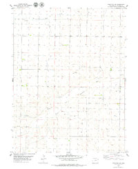
1979 Map of Stratton NW
USGS Topo · Published 1979About this map
South Fork Republican River meanders across this High Plains landscape, defining the local hydrology alongside its tributary, Hell Creek. The 1970s terrain is characterized by a sparse, systematic grid of section lines and range boundaries, including Range 48 West and Range 47 West, which reflect the organized agricultural and ranching layout of Kit Carson County. Grounded in this rural environment are specialized features such as Garner and numerous scattered wells, indicating the vital role of groundwater for local survival and operations. Industrial activity is visible through several Gravel Pits located near the riverbanks, suggesting local extraction of materials for roads and infrastructure. This survey provides a clear look at the landscape just before the turn of the decade, where the economy was tied closely to the land and the intermittent water sources of the eastern plains.
Find a feature on this map
8 named features on this map. Tap any name to fly to it.
Don’t see what you’re looking for? This feature index may not catch every label — zoom into the map to look around manually.
Map Details
Editions of this 1979 Stratton NW Map
This is the sole edition of this map. No revisions or reprints were ever made.
Other maps of this area

1954 · Limon
USGS Topo · 1:250,000

1957 · Limon
USGS Topo · 1:250,000

1958 · Limon
USGS Topo · 1:250,000

1969 · Tuttle
USGS Topo · 1:24,000

1969 · Kirk
USGS Topo · 1:24,000

1969 · Stratton
USGS Topo · 1:24,000

1977 · Cope SE
USGS Topo · 1:24,000
1978 · Joes SW
USGS Topo · 1:24,000

1979 · Vona
USGS Topo · 1:24,000

1979 · Seibert NE
USGS Topo · 1:24,000