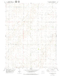
1979 Map of Alpine Ranch NW
USGS Topo · Published 1979About this map
Landsman Creek and its southern tributaries define this high plains landscape in eastern Colorado, where the topography is shaped by a network of intermittent watercourses. The 1970s land use is characterized by a sparse, grid-based infrastructure of section lines and fence boundaries, typical of large-scale ranching operations. Significant drainage features like Spring Creek and the East Branch Spring Creek move through the undulating terrain, while a high-pressure Pipeline cuts diagonally across the southeastern corner. Small-scale industrial activity is evidenced by a Gravel Pit in the northeast, providing a look at the localized resource extraction required to maintain the region's rural road network during this era of Kit Carson County history.
Find a feature on this map
5 named features on this map. Tap any name to fly to it.
Don’t see what you’re looking for? This feature index may not catch every label — zoom into the map to look around manually.
Map Details
Editions of this 1979 Alpine Ranch NW Map
This is the sole edition of this map. No revisions or reprints were ever made.
Other maps of this area

1954 · Limon
USGS Topo · 1:250,000

1957 · Limon
USGS Topo · 1:250,000

1958 · Limon
USGS Topo · 1:250,000

1969 · Alpine Ranch NE
USGS Topo · 1:24,000

1969 · Stratton
USGS Topo · 1:24,000

1969 · Alpine Ranch
USGS Topo · 1:24,000

1979 · Stratton 3 SE
USGS Topo · 1:24,000

1979 · Vona
USGS Topo · 1:24,000

1979 · Stratton 3 NE
USGS Topo · 1:24,000
1979 · Alpine Ranch SW
USGS Topo · 1:24,000