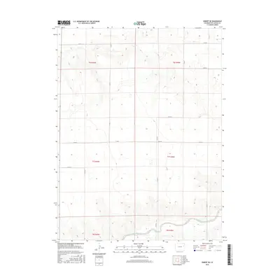
2016 Map of Seibert NE
USGS Topo · Published 2016About this map
The South Fork Republican River winds through the southern reaches of this high-plains landscape, marking a significant hydrologic feature in Kit Carson County. This 2016 survey highlights a sparse but organized agricultural grid defined by the Public Land Survey System, including sections within t6s r49w, t7s r48w, and t8s r49w. The land is dissected by seasonal drainage patterns, most notably Hell Cr in the north, which carves a path through the subtle elevation changes of the prairie.
Find a feature on this map
13 named features on this map. Tap any name to fly to it.
Don’t see what you’re looking for? This feature index may not catch every label — zoom into the map to look around manually.
Map Details
Editions of this 2016 Seibert NE Map
This is the sole edition of this map. No revisions or reprints were ever made.
Other maps of this area

1954 · Limon
USGS Topo · 1:250,000

1957 · Limon
USGS Topo · 1:250,000

1958 · Limon
USGS Topo · 1:250,000

1977 · Cope SE
USGS Topo · 1:24,000

1977 · Cope SW
USGS Topo · 1:24,000
1978 · Joes SW
USGS Topo · 1:24,000

1979 · Vona
USGS Topo · 1:24,000

1979 · Seibert NE
USGS Topo · 1:24,000
1979 · Seibert NW
USGS Topo · 1:24,000
1979 · Stratton NW
USGS Topo · 1:24,000