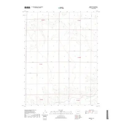
2019 Map of Seibert NE
USGS Topo · Published 2019About this map
South Fork Republican River defines the southern reach of this High Plains landscape, where the watercourse cuts through the agricultural grid of Kit Carson County. The terrain is shaped by the drainage patterns of Hell Cr in the north, showing the gradual erosion typical of the eastern Colorado steppe. This 2019 survey documents a vast network of county-maintained roads, such as Co Rd JJ and Co Rd EE, which partition the land into standard township and range sections. These survey lines illustrate the enduring legacy of the Public Land Survey System, dividing the high prairie into distinct blocks of private and public interest. The sparse distribution of named natural features suggests a landscape primarily dedicated to large-scale ranching or dryland farming, where water sources like Hell Cr are the primary landmarks for local navigation.
Find a feature on this map
13 named features on this map. Tap any name to fly to it.
Don’t see what you’re looking for? This feature index may not catch every label — zoom into the map to look around manually.
Map Details
Editions of this 2019 Seibert NE Map
This is the sole edition of this map. No revisions or reprints were ever made.
Other maps of this area

1954 · Limon
USGS Topo · 1:250,000

1957 · Limon
USGS Topo · 1:250,000

1958 · Limon
USGS Topo · 1:250,000

1977 · Cope SE
USGS Topo · 1:24,000

1977 · Cope SW
USGS Topo · 1:24,000
1978 · Joes SW
USGS Topo · 1:24,000

1979 · Vona
USGS Topo · 1:24,000

1979 · Seibert NE
USGS Topo · 1:24,000
1979 · Seibert NW
USGS Topo · 1:24,000
1979 · Stratton NW
USGS Topo · 1:24,000