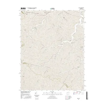
2016 Map of Seitz
USGS Topo · Published 2016About this map
Seitz and Fritz lie within the complex drainage network of the Kentucky mountains, where narrow hollows and steep ridgelines dictate the placement of local settlements and roads. This landscape is defined by its numerous small communities, such as Bays and Foraker, which are connected by a web of branch roads following the natural contours of the land. The presence of named features like Arnett Hollow and Bunker Bottom Flat highlights the traditional naming conventions that once guided local navigation. High-altitude thoroughfares like the Combs Mountain Pkwy contrast with the older, more intimate network of routes like Laurel Branch Rd and Cherry Orchard Branch Rd. This 2016 survey reflects a region where topographical constraints have preserved a traditional settlement pattern, centered around watercourses like the Left Fork Johnson.
Find a feature on this map
68 named features on this map. Tap any name to fly to it.
Don’t see what you’re looking for? This feature index may not catch every label — zoom into the map to look around manually.
Map Details
Editions of this 2016 Seitz Map
This is the sole edition of this map. No revisions or reprints were ever made.
Other maps of this area

1889 · Salyersville
USGS Topo · 1:125,000

1891 · Salyersville
USGS Topo · 1:125,000

1899 · Salyersville
USGS Topo · 1:125,000

1951 · Tiptop
USGS Topo · 1:24,000

1951 · Cannel City
USGS Topo · 1:24,000

1951 · Guage
USGS Topo · 1:24,000

1951 · White Oak
USGS Topo · 1:24,000
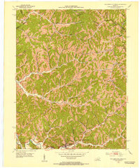
1951 · Salyersville North
USGS Topo · 1:24,000

1951 · Seitz
USGS Topo · 1:24,000

1951 · Quicksand
USGS Topo · 1:24,000