
2019 Map of Seitz
USGS Topo · Published 2019About this map
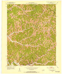
The Middle Fork Licking River and Right Fork Licking River define the intricate drainage patterns of this Magoffin County landscape, where small settlements like Seitz, Fritz, and Foraker are connected by narrow valley roads. The region is marked by an exceptional density of family burial grounds, reflecting deep genealogical roots in the hollows. Distinctive sites include the William Big Bill Patriotic Cem in the north and the Ambrose and Susan Arnett Cem near Hendricks. Modern infrastructure such as the Bert T Combs Mountain Pkwy cuts across the northern ridges, contrasting with the traditional named hollows like Arnett Hollow. The map detail captures a complex network of creeks including Puncheon Cr and Hunting Cr, which have historically dictated the placement of homes and small-scale agriculture on level ground like Bunker Bottom Flat.
Find a feature on this map
112 named features on this map. Tap any name to fly to it.
Don’t see what you’re looking for? This feature index may not catch every label — zoom into the map to look around manually.
Map Details
Editions of this 2019 Seitz Map
This is the sole edition of this map. No revisions or reprints were ever made.
Other maps of this area

1889 · Salyersville
USGS Topo · 1:125,000

1891 · Salyersville
USGS Topo · 1:125,000

1899 · Salyersville
USGS Topo · 1:125,000

1951 · Tiptop
USGS Topo · 1:24,000

1951 · Cannel City
USGS Topo · 1:24,000

1951 · Guage
USGS Topo · 1:24,000

1951 · White Oak
USGS Topo · 1:24,000
1951 · Salyersville North
USGS Topo · 1:24,000

1951 · Seitz
USGS Topo · 1:24,000

1951 · Quicksand
USGS Topo · 1:24,000