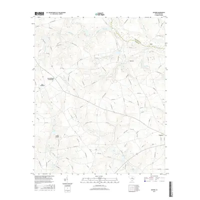
2017 Map of Seivern
USGS Topo · Published 2017About this map
The N Fork Edisto River defines the northeastern boundary of this landscape, carving a path through the sandhills of the South Carolina Midlands. The settlement of Seivern sits at a geographic crossroads, while New Holland Crossroads and New Holland represent established agricultural communities to the west. The terrain is defined by a dense network of blackwater drainages and millponds, such as Chalk Hill Millpond and Garvins Millpond, which hint at a long history of local water-powered industry. The crossing at Merritts Bridge serves as a vital link across the river between the Aiken and Lexington county lines. To the south, the town of Wagener anchors the map, showing the residential layout and infrastructure of this regional hub. From the wetlands of Dean Swamp Cr to family-named landmarks like Kennedy Pond, the map provides a clear view of the area's rural character and hydrologic network.
Find a feature on this map
102 named features on this map. Tap any name to fly to it.
Don’t see what you’re looking for? This feature index may not catch every label — zoom into the map to look around manually.
Map Details
Editions of this 2017 Seivern Map
This is the sole edition of this map. No revisions or reprints were ever made.
Other maps of this area

1920 · Aiken
USGS Topo · 1:48,000

1921 · Aiken
USGS Topo · 1:62,500

1943 · Aiken
USGS Topo · 1:62,500

1944 · Gilbert
USGS Topo · 1:62,500

1944 · Seivern
USGS Topo · 1:62,500

1954 · Augusta
USGS Topo · 1:250,000

1957 · Augusta
USGS Topo · 1:250,000

1958 · Augusta
USGS Topo · 1:250,000

1961 · Augusta
USGS Topo · 1:250,000

1962 · Augusta
USGS Topo · 1:250,000