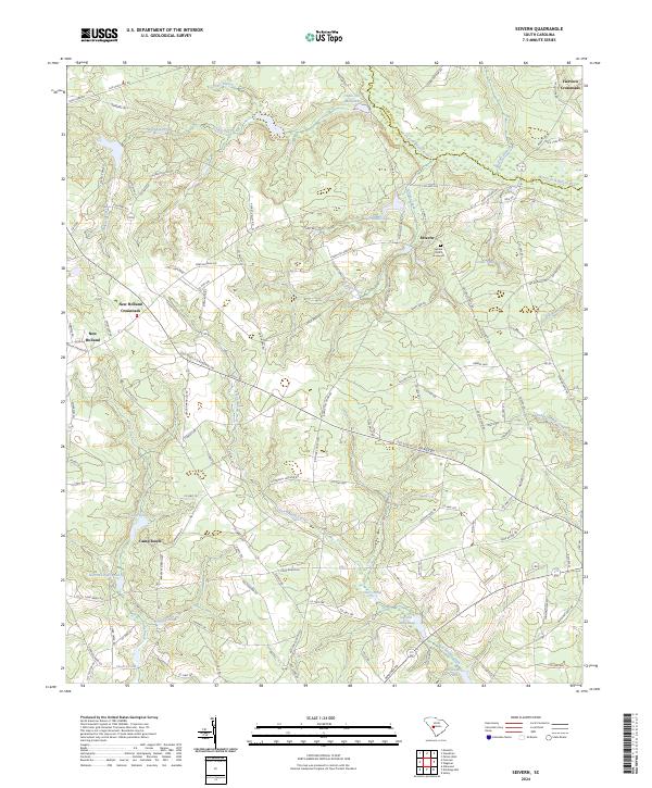
2024 Map of Seivern
USGS Topo · Published 2024About this map
Seivern and its surrounding countryside define the border between Lexington and Aiken counties, characterized by a complex network of wetlands and creek drainages that feed into the North Fork Edisto River. The landscape is dotted with evidence of early rural industry and community life, anchored by water-powered sites such as Chalk Hill Millpond and Garyins Millpond. Local history researchers will find several established settlements across this terrain, including New Holland Crossroads and Fairview Crossroads, which serve as key navigational points for the area's transition from agricultural fields to dense bottomlands.
Find a feature on this map
127 named features on this map. Tap any name to fly to it.
Don’t see what you’re looking for? This feature index may not catch every label — zoom into the map to look around manually.
Map Details
Editions of this 2024 Seivern Map
This is the sole edition of this map. No revisions or reprints were ever made.
Other maps of this area

1920 · Aiken
USGS Topo · 1:48,000

1921 · Aiken
USGS Topo · 1:62,500

1943 · Aiken
USGS Topo · 1:62,500

1944 · Gilbert
USGS Topo · 1:62,500

1944 · Seivern
USGS Topo · 1:62,500

1954 · Augusta
USGS Topo · 1:250,000

1957 · Augusta
USGS Topo · 1:250,000

1958 · Augusta
USGS Topo · 1:250,000

1961 · Augusta
USGS Topo · 1:250,000

1962 · Augusta
USGS Topo · 1:250,000