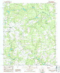
1986 Map of Seivern
USGS Topo · Published 1986About this map
The North Fork Edisto River forms the boundary between Lexington and Aiken Counties in this mid-1980s South Carolina survey. Small agricultural and industrial nodes like Seivern and New Holland dot the landscape, connected by a network of rural roads and light-duty tracks. The area shows a clear history of water-based activity and resource extraction, evidenced by the presence of Chalk Hill Millpond, Garvins Millpond, and scattered Clay Pits.
Find a feature on this map
23 named features on this map. Tap any name to fly to it.
Don’t see what you’re looking for? This feature index may not catch every label — zoom into the map to look around manually.
Map Details
Editions of this 1986 Seivern Map
This is the sole edition of this map. No revisions or reprints were ever made.
Other maps of this area

1920 · Aiken
USGS Topo · 1:48,000

1921 · Aiken
USGS Topo · 1:62,500

1943 · Aiken
USGS Topo · 1:62,500

1944 · Gilbert
USGS Topo · 1:62,500

1944 · Seivern
USGS Topo · 1:62,500

1954 · Augusta
USGS Topo · 1:250,000

1957 · Augusta
USGS Topo · 1:250,000

1958 · Augusta
USGS Topo · 1:250,000

1961 · Augusta
USGS Topo · 1:250,000

1962 · Augusta
USGS Topo · 1:250,000