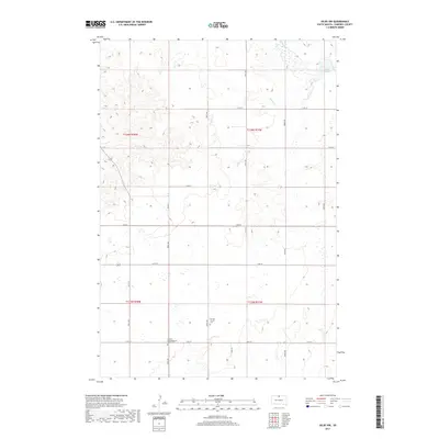
2017 Map of Selby NW
USGS Topo · Published 2017About this map
Agricultural heritage and spiritual landmarks define this portion of Campbell County, where the landscape is organized by a precise grid of rural section roads such as 297th Ave and 118th St. The map highlights the central role of community parishes in this prairie setting, specifically the Norway Church and the German Congregational Church. Both sites include associated grounds at the Norway Church Cem and German Congregational Church Cem, serving as vital records for genealogical research in the region. The terrain is drained by intermittent watercourses including Olson Cr and Locke Cr, which meander through the draws toward Lake Campbell in the northeast. This 2017 survey reflects a largely unchanged rural character, where the intersection of township lines and local gravel routes maintains the footprint of early homestead patterns.
Find a feature on this map
26 named features on this map. Tap any name to fly to it.
Don’t see what you’re looking for? This feature index may not catch every label — zoom into the map to look around manually.
Map Details
Editions of this 2017 Selby NW Map
This is the sole edition of this map. No revisions or reprints were ever made.
Other maps of this area

1953 · McIntosh
USGS Topo · 1:250,000

1958 · McIntosh
USGS Topo · 1:250,000

1965 · Herreid SW
USGS Topo · 1:24,000

1965 · Herreid
USGS Topo · 1:24,000

1965 · Pollock SE
USGS Topo · 1:24,000

1967 · Glenham
USGS Topo · 1:24,000

1967 · Mound City
USGS Topo · 1:24,000

1967 · Selby SW
USGS Topo · 1:24,000

1967 · Selby
USGS Topo · 1:24,000

1967 · Mobridge NE
USGS Topo · 1:24,000