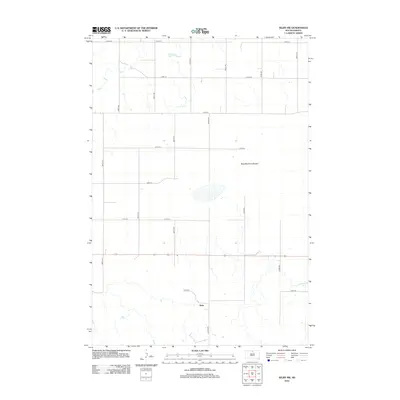
2012 Map of Selby SW
USGS Topo · Published 2012About this map
Sitka serves as the primary point of interest in this section of Walworth County, situated along the north-south corridor of 300th Ave. The landscape is dominated by the vast drainage patterns of the Blue Blanket Lakebed, a prominent natural feature that shapes the local hydrology and agricultural layout. The territory is precisely organized by a grid of rural roads, including 122nd St and 129th St, which facilitate movement between the scattered farmsteads typical of this South Dakota region. This 2012 survey captures the area’s persistent rural character, showing how modern transportation routes like the state highway follow long-established section lines, maintaining the essential connectivity of the Great Plains interior.
Find a feature on this map
17 named features on this map. Tap any name to fly to it.
Don’t see what you’re looking for? This feature index may not catch every label — zoom into the map to look around manually.
Map Details
Editions of this 2012 Selby SW Map
This is the sole edition of this map. No revisions or reprints were ever made.
Other maps of this area

1953 · McIntosh
USGS Topo · 1:250,000

1958 · McIntosh
USGS Topo · 1:250,000

1967 · Glenham
USGS Topo · 1:24,000

1967 · Mound City
USGS Topo · 1:24,000

1967 · Selby SW
USGS Topo · 1:24,000

1967 · Selby
USGS Topo · 1:24,000

1967 · Mobridge NE
USGS Topo · 1:24,000

1967 · Selby NW
USGS Topo · 1:24,000

1968 · Moreau NE
USGS Topo · 1:24,000

1968 · Akaska NW
USGS Topo · 1:24,000