
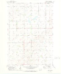
1967 Map of Selby
USGS Topo · Published 1969About this map
Selby serves as a primary hub in north-central South Dakota, shown here as it transitioned through the late 1960s. The town's layout is defined by its proximity to the Chicago Milwaukee St Paul and Pacific railroad, which runs east-west along the southern edge of the quadrangle. Outside the main settlement, the landscape is dotted with several significant local landmarks essential for genealogical research, including the Bethlehem Cemetery and Bethany Cemetery, along with the Bethany Church.
Find a feature on this map
20 named features on this map. Tap any name to fly to it.
Don’t see what you’re looking for? This feature index may not catch every label — zoom into the map to look around manually.
Map Details
Editions of this 1967 Selby Map
This is the sole edition of this map. No revisions or reprints were ever made.
Other maps of this area

1953 · McIntosh
USGS Topo · 1:250,000

1954 · Aberdeen
USGS Topo · 1:250,000

1956 · Aberdeen
USGS Topo · 1:250,000

1958 · McIntosh
USGS Topo · 1:250,000

1967 · Mound City
USGS Topo · 1:24,000

1967 · Selby SW
USGS Topo · 1:24,000

1967 · Selby NW
USGS Topo · 1:24,000

1968 · Akaska NW
USGS Topo · 1:24,000

1968 · Akaska NE
USGS Topo · 1:24,000
1974 · Lowry NW
USGS Topo · 1:24,000