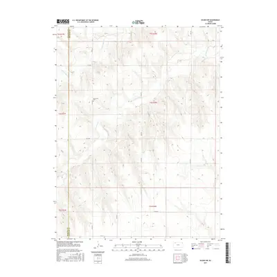
2015 Map of Selden NW
USGS Topo · Published 2015About this map
The High Plains landscape of Northwest Kansas is defined here by the drainage basins of the N Fork Sappa Cr and S Fork Sappa Cr. This 2015 survey illustrates a rural environment shaped by the Public Land Survey System, with a rigid grid of gravel roads like Co Rd 459 and 100th Rd traversing the hills. A significant site for genealogists and local historians is the Bassettville Cem, situated on a plateau overlooking the southern fork. The map traces the boundary between Rawlins and Decatur Counties, showing how the early agricultural layout has persisted into the 21st century. While the creek beds are the primary topographical features, the human imprint is most visible in the isolated section-line roads such as 300th Rd and Co Rd 352 that link distant farmsteads across the county line.
Find a feature on this map
20 named features on this map. Tap any name to fly to it.
Don’t see what you’re looking for? This feature index may not catch every label — zoom into the map to look around manually.
Map Details
Editions of this 2015 Selden NW Map
This is the sole edition of this map. No revisions or reprints were ever made.
Other maps of this area

1951 · Selden
USGS Topo · 1:62,500

1951 · Herndon
USGS Topo · 1:62,500

1951 · Achilles
USGS Topo · 1:62,500

1951 · Oberlin
USGS Topo · 1:62,500

1954 · Goodland
USGS Topo · 1:250,000

1956 · Goodland
USGS Topo · 1:250,000

1957 · Goodland
USGS Topo · 1:250,000

1965 · Oberlin
USGS Topo · 1:24,000

1965 · Oberlin SW
USGS Topo · 1:24,000

1965 · Achilles
USGS Topo · 1:24,000