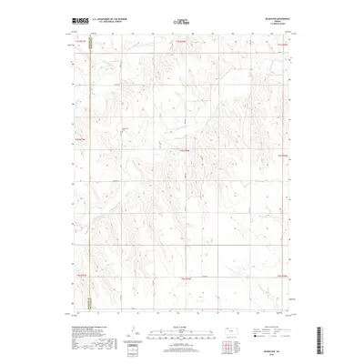
2018 Map of Selden NW
USGS Topo · Published 2018About this map
Bassettville Cem sits on a ridge overlooking the deeply eroded drainage basins of Northwest Kansas, serving as a primary point of historical interest in this agricultural landscape. The terrain is defined by the winding paths of the N Fork Sappa Cr and S Fork Sappa Cr, whose intermittent flows have carved intricate coulees into the High Plains. This 2018 survey illustrates the boundary between Rawlins Co and Decatur Co, where a rigid grid of section-line roads like Co Rd 459 and 100th Rd imposes order on the rugged natural topography. The map reveals the persistence of early land divisions and transport corridors in a region where the vast majority of the land remains dedicated to open-range or dryland farming, far from major urban centers.
Find a feature on this map
23 named features on this map. Tap any name to fly to it.
Don’t see what you’re looking for? This feature index may not catch every label — zoom into the map to look around manually.
Map Details
Editions of this 2018 Selden NW Map
This is the sole edition of this map. No revisions or reprints were ever made.
Other maps of this area

1951 · Selden
USGS Topo · 1:62,500

1951 · Herndon
USGS Topo · 1:62,500

1951 · Achilles
USGS Topo · 1:62,500

1951 · Oberlin
USGS Topo · 1:62,500

1954 · Goodland
USGS Topo · 1:250,000

1956 · Goodland
USGS Topo · 1:250,000

1957 · Goodland
USGS Topo · 1:250,000

1965 · Oberlin
USGS Topo · 1:24,000

1965 · Oberlin SW
USGS Topo · 1:24,000

1965 · Achilles
USGS Topo · 1:24,000