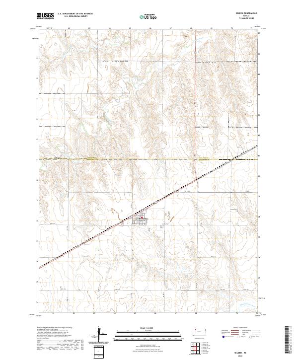
2022 Map of Selden
USGS Topo · Published 2022About this map
Selden serves as the primary hub of activity in this High Plains region, centered at the junction of the Decatur Co Sheridan Co boundary. The town's grid is clearly defined by several numbered thoroughfares, including 4th St, 5th St, and 6th St, which intersect with the central Main St. Outside the town center, the landscape is shaped by the headwaters and drainage of several significant watercourses, most notably Prairie Dog Cr and its N Fork Prairie Dog Cr branch, as well as the N Fork Solomon River in the southern reaches.
Find a feature on this map
24 named features on this map. Tap any name to fly to it.
Don’t see what you’re looking for? This feature index may not catch every label — zoom into the map to look around manually.
Map Details
Editions of this 2022 Selden Map
This is the sole edition of this map. No revisions or reprints were ever made.
Other maps of this area

1951 · Selden
USGS Topo · 1:62,500

1954 · Goodland
USGS Topo · 1:250,000

1956 · Goodland
USGS Topo · 1:250,000

1957 · Goodland
USGS Topo · 1:250,000

1965 · Selden NW
USGS Topo · 1:24,000
1965 · Selden NE
USGS Topo · 1:24,000
1978 · Dresden North
USGS Topo · 1:24,000

1978 · Selden
USGS Topo · 1:24,000

1978 · Selden SW
USGS Topo · 1:24,000

1978 · Dresden South
USGS Topo · 1:24,000