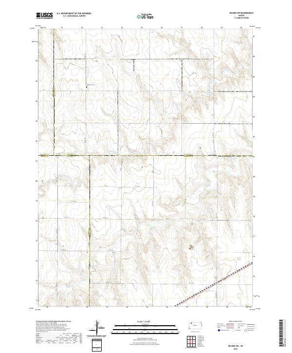
2022 Map of Selden SW
USGS Topo · Published 2022About this map
The rolling plains where Rawlins, Decatur, Thomas, and Sheridan counties meet reveal a landscape defined by its seasonal watercourses and straight-line section roads. The northern reach is anchored by the Hawkeye Cem, a lonely landmark situated along Co RD 459 that serves as a quiet reminder of early settlement patterns in this part of Kansas. The drainage system of the N Fork Prairie Dog Cr and the main channel of Prairie Dog Cr carve subtle elevation changes into the high plains, dictating the placement of the sparse road network. These creek beds and their intermittent flows represent the primary geographical variations in an otherwise orderly grid of agricultural section lines, including RD 110 N and Co RD 185.
Find a feature on this map
32 named features on this map. Tap any name to fly to it.
Don’t see what you’re looking for? This feature index may not catch every label — zoom into the map to look around manually.
Map Details
Editions of this 2022 Selden SW Map
This is the sole edition of this map. No revisions or reprints were ever made.
Other maps of this area

1951 · Selden
USGS Topo · 1:62,500

1951 · Achilles
USGS Topo · 1:62,500

1954 · Goodland
USGS Topo · 1:250,000

1956 · Goodland
USGS Topo · 1:250,000

1957 · Goodland
USGS Topo · 1:250,000

1965 · Achilles
USGS Topo · 1:24,000

1965 · Selden NW
USGS Topo · 1:24,000
1965 · Selden NE
USGS Topo · 1:24,000

1978 · Selden
USGS Topo · 1:24,000

1978 · Achilles SE
USGS Topo · 1:24,000