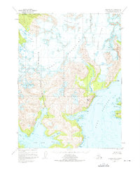
1951 Map of Seldovia B-3
USGS Topo · Published 1975About this map
The Kenai Mountains dominate this 1951 topographic survey, where massive ice fields carve deep fjords into the southern coast of the peninsula. Encompassing both the Kachemak Bay State Park and the Kachemak Bay State Wilderness Park, the landscape is defined by the slow movement of the Doroshin Glacier, Wosnesenski Glacier, and Petrof Glacier. These glaciers flow toward the intricate shorelines of the West Arm and Taylor Bay.
Find a feature on this map
24 named features on this map. Tap any name to fly to it.
Don’t see what you’re looking for? This feature index may not catch every label — zoom into the map to look around manually.
Map Details
Editions of this 1951 Seldovia B-3 Map
2 editions found
Other maps of this area

1948 · Seldovia C-4
USGS Topo · 1:63,360

1949 · Seldovia C-4
USGS Topo · 1:62,500

1951 · Seldovia
USGS Topo · 1:250,000

1951 · Seldovia A-3
USGS Topo · 1:63,360

1951 · Seldovia B-4
USGS Topo · 1:63,360

1951 · Seldovia B-2
USGS Topo · 1:63,360

1951 · Seldovia B-3
USGS Topo · 1:63,360

1951 · Seldovia A-4
USGS Topo · 1:63,360

1951 · Seldovia C-3
USGS Topo · 1:63,360

1952 · Seldovia A-3
USGS Topo · 1:63,360