
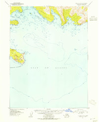
1951 Map of Seldovia A-3
USGS Topo · Published 1967About this map
Gore Point anchors the coastline of the Kenai Peninsula Borough in this mid-century hydrographic and topographic study. The landscape is defined by the sharp protrusion of Gore Peak and the nearby navigational landmark of Arch Rock, overlooking the convergence of Port Dick and the open Gulf of Alaska. Based on 1951 aerial photography and field annotation, the map emphasizes the maritime environment, including detailed bathymetric soundings and depth curves that trace the underwater shelf beyond the rocky shoreline. The interior remains largely unsurveyed and unmarked at this time, characterized by steep coastal elevations that descend abruptly into the gulf, illustrating the maritime isolation of this stretch of the southern Kenai Peninsula before modern infrastructure.
Find a feature on this map
6 named features on this map. Tap any name to fly to it.
Don’t see what you’re looking for? This feature index may not catch every label — zoom into the map to look around manually.
Map Details
Editions of this 1951 Seldovia A-3 Map
This is the sole edition of this map. No revisions or reprints were ever made.
Other maps of this area

1951 · Seldovia
USGS Topo · 1:250,000

1951 · Seldovia B-4
USGS Topo · 1:63,360

1951 · Seldovia B-2
USGS Topo · 1:63,360

1951 · Seldovia B-3
USGS Topo · 1:63,360

1951 · Seldovia A-4
USGS Topo · 1:63,360

1952 · Seldovia A-3
USGS Topo · 1:63,360

1952 · Seldovia B-3
USGS Topo · 1:63,360

1953 · Seldovia B-2
USGS Topo · 1:63,360

1953 · Seldovia B-4
USGS Topo · 1:63,360
1953 · Seldovia A-4
USGS Topo · 1:63,360