
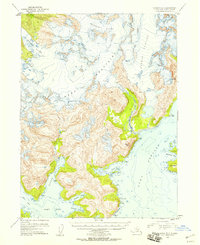
1952 Map of Seldovia B-3
USGS Topo · Published 1955About this map
The Kenai Mountains dominate this early 1950s coastal survey, showcasing a landscape defined by massive ice fields and deep tidal waters. Immense glaciers, including the Wosnesenski Glacier, Doroshin Glacier, and Petrof Glacier, carve through the high elevations, their crevasses and flow lines meticulously recorded from 1951 aerial photography. This era represents a significant period of topographic mapping in the Alaska-Third Judicial Division, capturing the shoreline before later 20th-century glacial retreats and seismic shifts altered the coastal profile.
Find a feature on this map
21 named features on this map. Tap any name to fly to it.
Don’t see what you’re looking for? This feature index may not catch every label — zoom into the map to look around manually.
Map Details
Editions of this 1952 Seldovia B-3 Map
2 editions found
Other maps of this area

1948 · Seldovia C-4
USGS Topo · 1:63,360

1949 · Seldovia C-4
USGS Topo · 1:62,500

1951 · Seldovia
USGS Topo · 1:250,000

1951 · Seldovia A-3
USGS Topo · 1:63,360

1951 · Seldovia B-4
USGS Topo · 1:63,360

1951 · Seldovia B-2
USGS Topo · 1:63,360

1951 · Seldovia B-3
USGS Topo · 1:63,360

1951 · Seldovia A-4
USGS Topo · 1:63,360

1951 · Seldovia C-3
USGS Topo · 1:63,360

1952 · Seldovia A-3
USGS Topo · 1:63,360