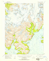
1952 Map of Seldovia B-3
USGS Topo · Published 1958About this map
The Kenai Mountains dominate this 1952 topographic study, where massive ice fields and deep glacial valleys define the landscape of the southern Kenai Peninsula. Significant glacial features including Doroshin Glacier, Wosnesenski Glacier, and Petrof Glacier are shown in high detail, with specific Crevasses noted across their frozen expanses. This era of mapping, compiled from 1951 aerial photography, captures the intricate relationship between the high-altitude Southern Glacier and the jagged coastline below.
Find a feature on this map
20 named features on this map. Tap any name to fly to it.
Don’t see what you’re looking for? This feature index may not catch every label — zoom into the map to look around manually.
Map Details
Editions of this 1952 Seldovia B-3 Map
2 editions found

Other maps of this area

1948 · Seldovia C-4
USGS Topo · 1:63,360

1949 · Seldovia C-4
USGS Topo · 1:62,500

1951 · Seldovia
USGS Topo · 1:250,000

1951 · Seldovia A-3
USGS Topo · 1:63,360

1951 · Seldovia B-4
USGS Topo · 1:63,360

1951 · Seldovia B-2
USGS Topo · 1:63,360

1951 · Seldovia B-3
USGS Topo · 1:63,360

1951 · Seldovia A-4
USGS Topo · 1:63,360

1951 · Seldovia C-3
USGS Topo · 1:63,360

1952 · Seldovia A-3
USGS Topo · 1:63,360