
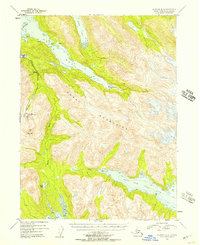
1953 Map of Seldovia B-4
USGS Topo · Published 1955About this map
The Kenai Mountains dominate this 1953 topographic study of the Kenai Peninsula, where glacial activity and coastal fjords define the landscape. Near the western slopes, the Kenai Chrome Mine sits north of Red Mountain, indicating the mid-century industrial interest in the region's mineral deposits. The coast is marked by deep inlets like Tutka Bay and Sadie Cove, where isolated cabins represent the sparse human footprint in this wilderness during the early 1950s.
Find a feature on this map
28 named features on this map. Tap any name to fly to it.
Don’t see what you’re looking for? This feature index may not catch every label — zoom into the map to look around manually.
Map Details
Editions of this 1953 Seldovia B-4 Map
2 editions found
Other maps of this area

1946 · Seldovia C-5
USGS Topo · 1:63,360

1948 · Seldovia C-4
USGS Topo · 1:63,360

1949 · Seldovia C-4
USGS Topo · 1:62,500

1951 · Seldovia C-5
USGS Topo · 1:63,360

1951 · Seldovia
USGS Topo · 1:250,000

1951 · Seldovia B-5
USGS Topo · 1:63,360

1951 · Seldovia A-3
USGS Topo · 1:63,360

1951 · Seldovia B-4
USGS Topo · 1:63,360

1951 · Seldovia B-3
USGS Topo · 1:63,360

1951 · Seldovia A-4
USGS Topo · 1:63,360