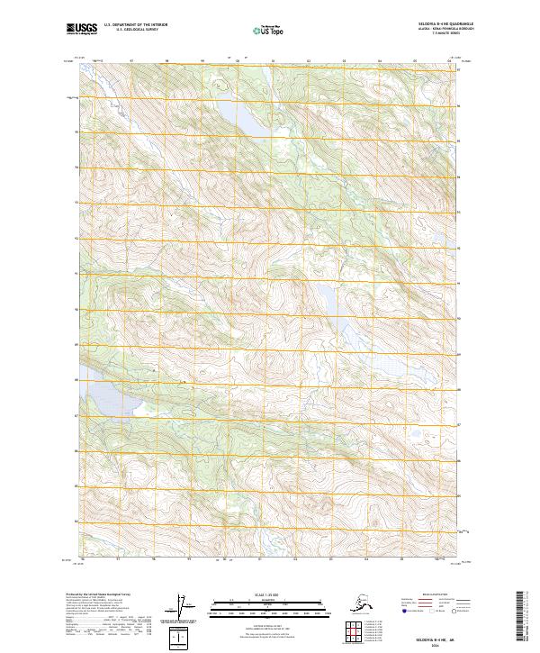
2024 Map of Seldovia B-4 NE
USGS Topo · Published 2024About this map
Glaciated terrain and high-altitude lakes dominate this 2024 survey of the southern Kenai Peninsula. The landscape is defined by its dramatic relief, with steep ridgelines and alpine basins falling between the surveyed boundaries of T8s R12w and T8s R11w. This modern map is part of the US Topo series, utilizing SPOT imagery and National Hydrography Dataset information to precisely document the current state of these subarctic wetlands and waterways. The lack of named settlements or transportation infrastructure within T9s R12w and T9s R11w highlights the untamed character of this Alaskan interior, where natural contours and water bodies are the primary landmarks. Researchers focusing on public land systems or environmental change will find this contemporary record essential for tracking shoreline shifts and glacial recession.
Find a feature on this map
4 named features on this map. Tap any name to fly to it.
Don’t see what you’re looking for? This feature index may not catch every label — zoom into the map to look around manually.
Map Details
Editions of this 2024 Seldovia B-4 NE Map
This is the sole edition of this map. No revisions or reprints were ever made.
Other maps of this area

1948 · Seldovia C-4
USGS Topo · 1:63,360

1949 · Seldovia C-4
USGS Topo · 1:62,500

1951 · Seldovia
USGS Topo · 1:250,000

1951 · Seldovia B-4
USGS Topo · 1:63,360

1951 · Seldovia B-3
USGS Topo · 1:63,360

1951 · Seldovia C-3
USGS Topo · 1:63,360

1952 · Seldovia B-3
USGS Topo · 1:63,360

1953 · Seldovia C-3
USGS Topo · 1:63,360

1953 · Seldovia B-4
USGS Topo · 1:63,360
1961 · Seldovia C-4
USGS Topo · 1:63,360