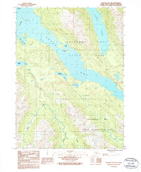
1987 Map of Seldovia B-4 NW
USGS Topo · Published 1987About this map
Kachemak Bay State Park and the expansive Kachemak Bay State Wilderness Park dominate this coastal survey of the Kenai Peninsula. The landscape is defined by the deep, glacial waters of Tutka Bay and Sadie Cove, where the shoreline is punctuated by islands such as San Juan Island and the Herring Islands. The complex maritime geography includes the protected Tutka Bay Lagoon and the narrow inlet of Little Tutka Bay, while the interior is drained by systems like the Windy River and Rocky River. This 1980s-era documentation highlights the transition from the marine environments of Kachemak Bay to the steep, undeveloped wilderness, featuring isolated landmarks like the Grass Island Azimuth Mark and the sheltered San Juan Cove.
Find a feature on this map
16 named features on this map. Tap any name to fly to it.
Don’t see what you’re looking for? This feature index may not catch every label — zoom into the map to look around manually.
Map Details
Editions of this 1987 Seldovia B-4 NW Map
This is the sole edition of this map. No revisions or reprints were ever made.
Other maps of this area

1946 · Seldovia C-5
USGS Topo · 1:63,360

1948 · Seldovia C-4
USGS Topo · 1:63,360

1949 · Seldovia C-4
USGS Topo · 1:62,500

1951 · Seldovia C-5
USGS Topo · 1:63,360

1951 · Seldovia
USGS Topo · 1:250,000

1951 · Seldovia B-5
USGS Topo · 1:63,360

1951 · Seldovia B-4
USGS Topo · 1:63,360

1953 · Seldovia B-4
USGS Topo · 1:63,360

1953 · Seldovia B-5
USGS Topo · 1:63,360

1961 · Seldovia C-5
USGS Topo · 1:63,360