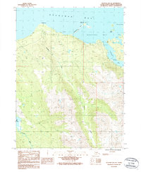
1987 Map of Seldovia B-5 NE
USGS Topo · Published 1987About this map
Kachemak Bay dominates the northern reaches of this coastal Alaskan landscape, where the tides carve a jagged shoreline into the Kenai Peninsula. The maritime character of the region is evident in the specialized infrastructure along the eastern inlets, featuring a Seaplane Anchorage, a Boat Dock, and a Dock nestled within Jakolof Bay. These coastal features suggest a localized economy dependent on water and air travel, common in road-sparse regions of Alaska during the late 1980s.
Find a feature on this map
16 named features on this map. Tap any name to fly to it.
Don’t see what you’re looking for? This feature index may not catch every label — zoom into the map to look around manually.
Map Details
Editions of this 1987 Seldovia B-5 NE Map
This is the sole edition of this map. No revisions or reprints were ever made.
Other maps of this area

1946 · Seldovia C-5
USGS Topo · 1:63,360

1948 · Seldovia C-4
USGS Topo · 1:63,360

1949 · Seldovia C-4
USGS Topo · 1:62,500

1951 · Seldovia C-5
USGS Topo · 1:63,360

1951 · Seldovia
USGS Topo · 1:250,000

1951 · Seldovia B-5
USGS Topo · 1:63,360

1951 · Seldovia B-4
USGS Topo · 1:63,360

1953 · Seldovia B-4
USGS Topo · 1:63,360

1953 · Seldovia B-5
USGS Topo · 1:63,360

1961 · Seldovia C-5
USGS Topo · 1:63,360