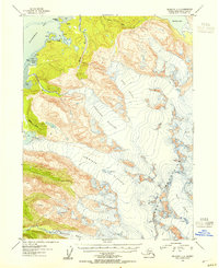
1953 Map of Seldovia C-3
USGS Topo · Published 1954About this map
Glacial ice dominates this 1950s study of the Kenai Mountains, where massive flows like Grewingk Glacier and Portlock Glacier reach toward the coast. The topography reveals a dramatic vertical landscape defined by deep crevasses and high alpine basins that feed coastal waters. Along the southern edge of Kachemak Bay, the map documents several remote cabins and a lone cabin near Bear Cove, indicating the sparse seasonal human presence in this wilderness at the time of the survey. The intricate shoreline of Aurora Lagoon and the narrow Aurora Spit contrast with the inland frozen expanse of Dixon Glacier. This map provides a detailed view of the drainage systems from Bradley Lake and Battle Creek before later 20th-century developments reached this portion of the Kenai Peninsula.
Find a feature on this map
21 named features on this map. Tap any name to fly to it.
Don’t see what you’re looking for? This feature index may not catch every label — zoom into the map to look around manually.
Map Details
Editions of this 1953 Seldovia C-3 Map
3 editions found

Other maps of this area

1948 · Seldovia C-4
USGS Topo · 1:63,360

1949 · Seldovia C-4
USGS Topo · 1:62,500

1949 · Seldovia D-4
USGS Topo · 1:63,360

1950 · Seldovia D-2
USGS Topo · 1:63,360

1951 · Seldovia D-4
USGS Topo · 1:63,360

1951 · Seldovia
USGS Topo · 1:250,000

1951 · Seldovia D-3
USGS Topo · 1:63,360

1951 · Seldovia B-4
USGS Topo · 1:63,360

1951 · Seldovia B-2
USGS Topo · 1:63,360

1951 · Seldovia B-3
USGS Topo · 1:63,360