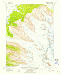
1953 Map of Seldovia C-3
USGS Topo · Published 1958About this map
Grewingk Glacier and the massive ice fields of the Kenai Mountains dominate this 1953 survey, illustrating a landscape defined by glacial flow and coastal transition. Along the eastern shores of Kachemak Bay, the map documents scattered cabins at Bear Cove and near the Aurora Spit, indicating the sparse seasonal or maritime settlement of the era. The hydrography, compiled from coastal charts, shows the intricate drainage of the Martin River and Battle Creek feeding into the bay from the high mountain interior. Several distinct glaciers, including Dixon Glacier and Portlock Glacier, are shown with extensive crevasses at their higher elevations, providing a clear record of these ice bodies before mid-century changes. The presence of Bradley Lake and the Aurora Lagoon further highlight the diverse aquatic environments found where the glacial runoff meets the tidal waters of the Kenai Peninsula.
Find a feature on this map
21 named features on this map. Tap any name to fly to it.
Don’t see what you’re looking for? This feature index may not catch every label — zoom into the map to look around manually.
Map Details
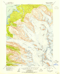
Editions of this 1953 Seldovia C-3 Map
3 editions found

Other maps of this area

1948 · Seldovia C-4
USGS Topo · 1:63,360

1949 · Seldovia C-4
USGS Topo · 1:62,500

1949 · Seldovia D-4
USGS Topo · 1:63,360

1950 · Seldovia D-2
USGS Topo · 1:63,360

1951 · Seldovia D-4
USGS Topo · 1:63,360

1951 · Seldovia
USGS Topo · 1:250,000

1951 · Seldovia D-3
USGS Topo · 1:63,360

1951 · Seldovia B-4
USGS Topo · 1:63,360

1951 · Seldovia B-2
USGS Topo · 1:63,360

1951 · Seldovia B-3
USGS Topo · 1:63,360