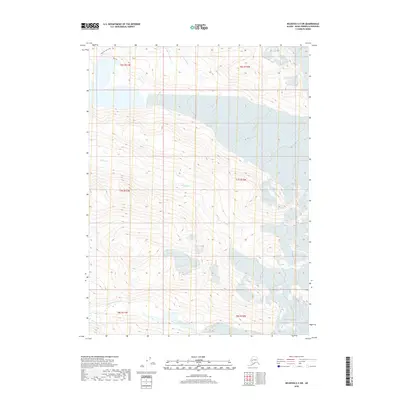
2018 Map of Seldovia C-3 SW
USGS Topo · Published 2018About this map
The Wosnesenski River flows through the southern reaches of this Kenai Peninsula landscape, carving through a glacial terrain defined by deep valleys and high ice-covered peaks. In the northern section, the Emerald Lake Loop and the presence of Blue Ice indicate a high-elevation environment where frozen features persist. This survey captures a drainage system characterized by several streams, including Halibut Cr and Humpy Cr, which snake through the steep topography. The map illustrates a largely unsettled wilderness where the natural hydrology of the river and creeks remains the primary geographical framework, offering a look at the undisturbed glacial runoff patterns common to this part of Alaska.
Find a feature on this map
11 named features on this map. Tap any name to fly to it.
Don’t see what you’re looking for? This feature index may not catch every label — zoom into the map to look around manually.
Map Details
Editions of this 2018 Seldovia C-3 SW Map
This is the sole edition of this map. No revisions or reprints were ever made.
Other maps of this area

1948 · Seldovia C-4
USGS Topo · 1:63,360

1949 · Seldovia C-4
USGS Topo · 1:62,500

1951 · Seldovia
USGS Topo · 1:250,000

1951 · Seldovia B-4
USGS Topo · 1:63,360

1951 · Seldovia B-3
USGS Topo · 1:63,360

1951 · Seldovia C-3
USGS Topo · 1:63,360

1952 · Seldovia B-3
USGS Topo · 1:63,360

1953 · Seldovia C-3
USGS Topo · 1:63,360

1953 · Seldovia B-4
USGS Topo · 1:63,360
1961 · Seldovia C-4
USGS Topo · 1:63,360