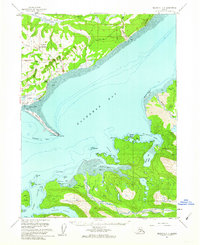
1961 Map of Seldovia C-4
USGS Topo · Published 1962About this map
Kachemak Bay dominates this coastal survey, where the long, slender finger of the Homer Spit reaches out toward Coal Point. The settlement of Homer is shown with its early infrastructure, including Beluga Lake, the Homer Airport, and several radio towers. Along the northern shoreline, Millers Landing and a Quarry sit beneath the elevation of Lookout Mountain and Crossman Ridge. Across the water to the south, the landscape becomes significantly more complex with the deep incisions of China Poot Bay, Sadie Cove, and Halibut Cove. This 1961 field-annotated map captures a critical era of transition for the Kenai Peninsula, documenting the maritime-dependent life of the region before further modern expansion. The presence of the Grewingk Glacier and its associated Glacier Spit illustrates the dynamic glacial environment that shapes the eastern reach of the bay.
Find a feature on this map
58 named features on this map. Tap any name to fly to it.
Don’t see what you’re looking for? This feature index may not catch every label — zoom into the map to look around manually.
Map Details
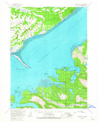
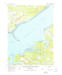
Editions of this 1961 Seldovia C-4 Map
3 editions found
Other maps of this area

1946 · Seldovia C-5
USGS Topo · 1:63,360

1946 · Seldovia D-5
USGS Topo · 1:63,360

1948 · Seldovia C-4
USGS Topo · 1:63,360

1949 · Seldovia C-4
USGS Topo · 1:62,500

1949 · Seldovia D-4
USGS Topo · 1:63,360

1951 · Seldovia C-5
USGS Topo · 1:63,360

1951 · Seldovia D-5
USGS Topo · 1:63,360

1951 · Seldovia D-4
USGS Topo · 1:63,360

1951 · Seldovia
USGS Topo · 1:250,000

1951 · Seldovia D-3
USGS Topo · 1:63,360