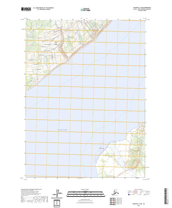
2024 Map of Seldovia C-4 NE
USGS Topo · Published 2024About this map
Fritz Creek anchors the northern portion of this coastal landscape on the Kenai Peninsula, where a dense network of local roads and family-named avenues meet the shore. The terrain is defined by the sharp descent from the plateau down through McNeil Canyon toward the Pacific Ocean. To the south, the environment shifts toward a more primitive state as the land gives way to the glacial outwash of Grewingk Creek and the distinctive formation of Glacier Spit.
Find a feature on this map
34 named features on this map. Tap any name to fly to it.
Don’t see what you’re looking for? This feature index may not catch every label — zoom into the map to look around manually.
Map Details
Editions of this 2024 Seldovia C-4 NE Map
This is the sole edition of this map. No revisions or reprints were ever made.
Other maps of this area

1948 · Seldovia C-4
USGS Topo · 1:63,360

1949 · Seldovia C-4
USGS Topo · 1:62,500

1949 · Seldovia D-4
USGS Topo · 1:63,360

1951 · Seldovia D-4
USGS Topo · 1:63,360

1951 · Seldovia
USGS Topo · 1:250,000

1951 · Seldovia D-3
USGS Topo · 1:63,360

1951 · Seldovia C-3
USGS Topo · 1:63,360

1953 · Seldovia C-3
USGS Topo · 1:63,360
1953 · Seldovia D-3
USGS Topo · 1:63,360
1961 · Seldovia C-4
USGS Topo · 1:63,360