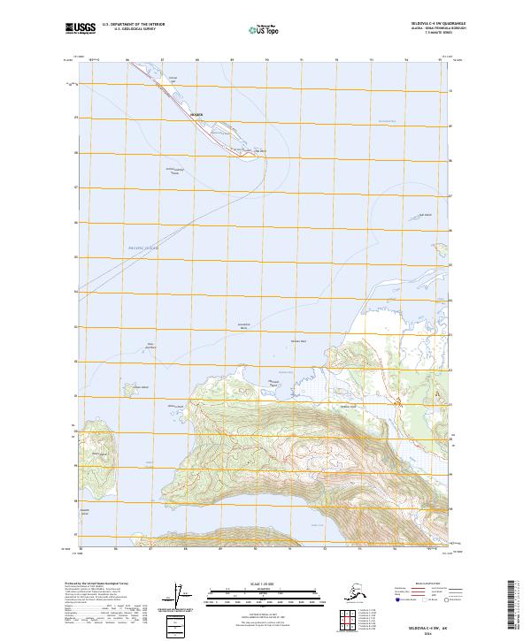
2024 Map of Seldovia C-4 SW
USGS Topo · Published 2024About this map
Homer Spit extends into the waters of Kachemak Bay, anchoring the maritime geography of the Kenai Peninsula. This modern survey illustrates the critical infrastructure at Coal Point, including Outer Dock Road and Freight Dock Road, which connect the mainland via the Sterling Highway. Across the bay, the landscape transitions into the protected territory of the Alaska Maritime National Wildlife Refuge, where a network of trails like the Sadie Knob North Trl and Grace Ridge Trl traverse the high ground between Neptune Bay and Sadie Cove. The map details numerous islands and hazards, from Yukon Island and Hesketh Island in the west to the isolated Gull Island and Lancashire Rocks, defining a coastline shaped by dramatic tidal shifts and glacial runoff from the Wosnesenski River.
Find a feature on this map
37 named features on this map. Tap any name to fly to it.
Don’t see what you’re looking for? This feature index may not catch every label — zoom into the map to look around manually.
Map Details
Editions of this 2024 Seldovia C-4 SW Map
This is the sole edition of this map. No revisions or reprints were ever made.
Other maps of this area

1946 · Seldovia C-5
USGS Topo · 1:63,360

1948 · Seldovia C-4
USGS Topo · 1:63,360

1949 · Seldovia C-4
USGS Topo · 1:62,500

1951 · Seldovia C-5
USGS Topo · 1:63,360

1951 · Seldovia
USGS Topo · 1:250,000

1951 · Seldovia B-5
USGS Topo · 1:63,360

1951 · Seldovia B-4
USGS Topo · 1:63,360

1953 · Seldovia B-4
USGS Topo · 1:63,360

1953 · Seldovia B-5
USGS Topo · 1:63,360

1961 · Seldovia C-5
USGS Topo · 1:63,360