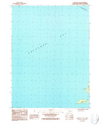
1987 Map of Seldovia C-5 SE
USGS Topo · Published 1987About this map
Kachemak Bay dominates this marine-focused survey, showcasing the coastal reaches of the Kenai Peninsula in the late 1980s. The map highlights the maritime geography of the area, specifically focusing on the southern islands such as Yukon Island and Hesketh Island. These landforms are noted as part of the Alaska Maritime National Wildlife Refuge, a designation encompassing the islands, reefs, and spires throughout these coastal waters. Small navigational or topographic markers like Yukon and Snack provide specific points of reference on the islands. At the northern edge, the Homer Corporate Boundary stretches across the open water, indicating the administrative reach of the nearby settlement into the bay during this era of Alaskan coastal management.
Find a feature on this map
7 named features on this map. Tap any name to fly to it.
Don’t see what you’re looking for? This feature index may not catch every label — zoom into the map to look around manually.
Map Details
Editions of this 1987 Seldovia C-5 SE Map
This is the sole edition of this map. No revisions or reprints were ever made.
Other maps of this area

1946 · Seldovia C-5
USGS Topo · 1:63,360

1948 · Seldovia C-4
USGS Topo · 1:63,360

1949 · Seldovia C-4
USGS Topo · 1:62,500

1951 · Seldovia C-5
USGS Topo · 1:63,360

1951 · Seldovia
USGS Topo · 1:250,000

1951 · Seldovia B-5
USGS Topo · 1:63,360

1951 · Seldovia B-4
USGS Topo · 1:63,360

1953 · Seldovia B-4
USGS Topo · 1:63,360

1953 · Seldovia B-5
USGS Topo · 1:63,360

1961 · Seldovia C-5
USGS Topo · 1:63,360