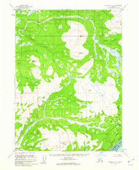
1961 Map of Seldovia D-4
USGS Topo · Published 1962About this map
Ninilchik Dome and the Caribou Hills define the high country of the southern Kenai Peninsula in the early 1960s. The landscape is characterized by a dense network of watercourses, with the Anchor River and Deep Creek carving through the terrain toward the western coast. This era shows the region before modern highway development reached deep into the interior, as evidenced by a lonely Tractor Trail being the primary route through the southern sections near Bald Mountain.
Find a feature on this map
25 named features on this map. Tap any name to fly to it.
Don’t see what you’re looking for? This feature index may not catch every label — zoom into the map to look around manually.
Map Details
Editions of this 1961 Seldovia D-4 Map
3 editions found
Other maps of this area

1944 · Kenai
USGS Topo · 1:250,000

1946 · Seldovia C-5
USGS Topo · 1:63,360

1946 · Seldovia D-5
USGS Topo · 1:63,360

1948 · Seldovia C-4
USGS Topo · 1:63,360

1949 · Seldovia C-4
USGS Topo · 1:62,500

1949 · Seldovia D-4
USGS Topo · 1:63,360

1950 · Kenai
USGS Topo · 1:250,000

1951 · Seldovia C-5
USGS Topo · 1:63,360

1951 · Seldovia D-5
USGS Topo · 1:63,360

1951 · Seldovia D-4
USGS Topo · 1:63,360