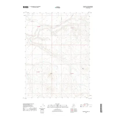
2018 Map of Seldovia D-4 NW
USGS Topo · Published 2018About this map
Ninilchik Dome rises as a prominent landmark in this interior section of the Kenai Peninsula, where the landscape is defined by the drainage systems of the western coast. The map illustrates a network of waterways that eventually reach the Cook Inlet, including Deep Cr, S Fork Deep Cr, Clam Cr, and Stariski Cr. Human presence in this area is primarily indicated by infrastructure related to resource access, most notably Oil Well Road which traverses the northern townships. The intersection of wilderness and modern access is further marked by the presence of Hostetter Street, suggesting localized development or access points within the timbered terrain. This 2018 survey serves as a record of the peninsula's topography and road layout at the end of the second decade of the 21st century.
Find a feature on this map
12 named features on this map. Tap any name to fly to it.
Don’t see what you’re looking for? This feature index may not catch every label — zoom into the map to look around manually.
Map Details
Editions of this 2018 Seldovia D-4 NW Map
This is the sole edition of this map. No revisions or reprints were ever made.
Other maps of this area

1944 · Kenai
USGS Topo · 1:250,000

1946 · Seldovia D-5
USGS Topo · 1:63,360

1949 · Seldovia D-4
USGS Topo · 1:63,360

1950 · Kenai
USGS Topo · 1:250,000

1951 · Seldovia D-5
USGS Topo · 1:63,360

1951 · Seldovia D-4
USGS Topo · 1:63,360

1951 · Seldovia
USGS Topo · 1:250,000

1951 · Kenai A-5
USGS Topo · 1:63,360

1951 · Kenai A-4
USGS Topo · 1:63,360

1952 · Kenai A-5
USGS Topo · 1:63,360