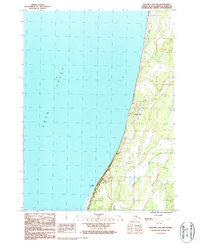
1987 Map of Seldovia D-5 NW
USGS Topo · Published 1987About this map
Happy Valley sits along the coastal bluff of the Kenai Peninsula, overlooking the expansive waters of Cook Inlet. The settlement is defined by its proximity to the shoreline, where Cape Starichkof marks a prominent point in the south. This 1987 provisional survey illustrates a landscape of functional infrastructure and natural waterways, featuring Stariski Creek and Happy Creek winding through the terrain. Evidence of local utility and transport is clear through the presence of a trans line and a radio tower. This map provides a look at the area's development during the late 1980s, documenting local landmarks like the Rodeo Ground and various gravel pits that speak to the region's mid-century growth and resource use. The map also includes a Winter Trail and several 4wd routes, indicating the seasonal and rugged nature of travel in this part of Alaska.
Find a feature on this map
12 named features on this map. Tap any name to fly to it.
Don’t see what you’re looking for? This feature index may not catch every label — zoom into the map to look around manually.
Map Details
Editions of this 1987 Seldovia D-5 NW Map
This is the sole edition of this map. No revisions or reprints were ever made.
Other maps of this area

1944 · Kenai
USGS Topo · 1:250,000

1946 · Seldovia D-5
USGS Topo · 1:63,360

1950 · Kenai
USGS Topo · 1:250,000

1951 · Seldovia D-5
USGS Topo · 1:63,360

1951 · Seldovia
USGS Topo · 1:250,000

1951 · Kenai A-5
USGS Topo · 1:63,360

1952 · Kenai A-5
USGS Topo · 1:63,360

1958 · Kenai
USGS Topo · 1:250,000
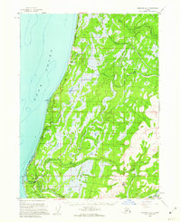
1961 · Seldovia D-5
USGS Topo · 1:63,360

1963 · Seldovia
USGS Topo · 1:250,000