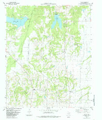
1984 Map of Selfs
USGS Topo · Published 1985About this map
Bois d'Arc Creek and its tributary system define this rural pocket of Fannin County, where the 1970s landscape was shaped by the waters of Coffee Mill Lake and Lake Crockett. The terrain is marked by a network of small drainage ways including Honey Grove Creek, Sandy Creek, and Spoonamore Creek, which carve through the countryside north of the Red River valley. This area maintains a quiet, decentralized character, with small community nodes like Selfs, Sash, and Allens Point serving as the primary landmarks in an otherwise agrarian expanse.
Find a feature on this map
27 named features on this map. Tap any name to fly to it.
Don’t see what you’re looking for? This feature index may not catch every label — zoom into the map to look around manually.
Map Details
Editions of this 1984 Selfs Map
This is the sole edition of this map. No revisions or reprints were ever made.
Other maps of this area

1903 · Paris
USGS Topo · 1:125,000

1947 · Honey Grove
USGS Topo · 1:62,500

1948 · Direct
USGS Topo · 1:62,500

1949 · Direct
USGS Topo · 1:62,500

1949 · Honey Grove
USGS Topo · 1:62,500

1953 · Texarkana
USGS Topo · 1:250,000

1954 · Sherman
USGS Topo · 1:250,000

1956 · Texarkana
USGS Topo · 1:250,000

1957 · Wade
USGS Topo · 1:62,500

1958 · Bonham
USGS Topo · 1:62,500