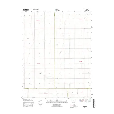
2015 Map of Selkirk SE
USGS Topo · Published 2015About this map
James Draw cuts a shallow path through this High Plains landscape where the corners of four Kansas counties meet. Located on the western edge of the state, this survey illustrates a strictly organized agricultural grid, with long straight section roads such as Co Rd 26 and Co Rd X defining the township lines. The intersection of Greeley, Wichita, Hamilton, and Kearny counties in the southern portion of the map highlights a unique geographic junction in the Great Plains region. The terrain is characterized by subtle drainage depressions and playa-like features, reflecting the arid nature of the environment where ephemeral watercourses like James Draw represent the primary topographical relief. Grounded in the Public Land Survey System, the map clearly delineates township boundaries from t19s r38w through t21s r39w, providing a clear framework for local property research.
Find a feature on this map
33 named features on this map. Tap any name to fly to it.
Don’t see what you’re looking for? This feature index may not catch every label — zoom into the map to look around manually.
Map Details
Editions of this 2015 Selkirk SE Map
This is the sole edition of this map. No revisions or reprints were ever made.
Other maps of this area

1955 · Scott City
USGS Topo · 1:250,000

1958 · Scott City
USGS Topo · 1:250,000

1965 · Leoti 3 NW
USGS Topo · 1:24,000

1966 · Tribune 4 NW
USGS Topo · 1:24,000

1966 · Tribune 4 NE
USGS Topo · 1:24,000

1970 · Selkirk SW
USGS Topo · 1:24,000

1970 · Selkirk SE
USGS Topo · 1:24,000

1970 · Selkirk
USGS Topo · 1:24,000

1970 · Leoti NW
USGS Topo · 1:24,000

1970 · Selkirk NW
USGS Topo · 1:24,000