
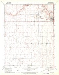
1970 Map of Selkirk NW
USGS Topo · Published 1972About this map
Tribune serves as the primary hub of activity in this High Plains landscape, situated along the Missouri Pacific railroad line. The rail corridor is the defining artery for the area's development, connecting the larger settlement at Tribune to the smaller station point at Whitelaw to the east. Agriculture and infrastructure are visible through features like the Pringle Ranch Landing Field and various Gravel Pits, which signify the practical requirements of rural life and road maintenance in Greeley County during the early 1970s.
Find a feature on this map
12 named features on this map. Tap any name to fly to it.
Don’t see what you’re looking for? This feature index may not catch every label — zoom into the map to look around manually.
Map Details
Editions of this 1970 Selkirk NW Map
This is the sole edition of this map. No revisions or reprints were ever made.
Other maps of this area

1955 · Scott City
USGS Topo · 1:250,000

1958 · Scott City
USGS Topo · 1:250,000

1970 · Selkirk SW
USGS Topo · 1:24,000

1970 · Sharon Springs 4 SE
USGS Topo · 1:24,000

1970 · Sharon Springs 3 SE
USGS Topo · 1:24,000

1970 · Sharon Springs 4 SW
USGS Topo · 1:24,000

1970 · Selkirk SE
USGS Topo · 1:24,000

1970 · Selkirk
USGS Topo · 1:24,000

1970 · Tribune SE
USGS Topo · 1:24,000
1970 · Tribune
USGS Topo · 1:24,000